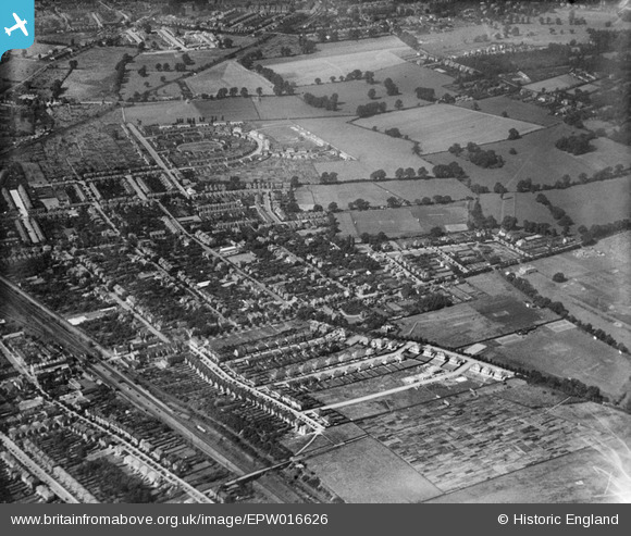
EPW016626 ENGLAND (1926). Lime Grove and environs, New Malden, 1926
© Copyright OpenStreetMap contributors and licensed by the OpenStreetMap Foundation. 2026. Cartography is licensed as CC BY-SA.
Details
| Title | [EPW016626] Lime Grove and environs, New Malden, 1926 |
| Reference | EPW016626 |
| Date | August-1926 |
| Link | |
| Place name | NEW MALDEN |
| Parish | |
| District | |
| Country | ENGLAND |
| Easting / Northing | 521004, 169003 |
| Longitude / Latitude | -0.26007290668109, 51.406632539603 |
| National Grid Reference | TQ210690 |
Pins

@JohnSouthsea |
Thursday 20th of February 2014 01:57:03 PM | |

@JohnSouthsea |
Thursday 20th of February 2014 01:56:26 PM | |

@JohnSouthsea |
Thursday 20th of February 2014 01:55:16 PM | |

@JohnSouthsea |
Thursday 20th of February 2014 01:53:28 PM | |

@JohnSouthsea |
Thursday 20th of February 2014 01:52:42 PM | |

@JohnSouthsea |
Thursday 20th of February 2014 01:51:39 PM | |

@JohnSouthsea |
Thursday 20th of February 2014 01:51:05 PM |


![[EPW016626] Lime Grove and environs, New Malden, 1926](http://britainfromabove.org.uk/sites/all/libraries/aerofilms-images/public/100x100/EPW/016/EPW016626.jpg)
![[EPW016628] Elm Road and environs, New Malden, 1926](http://britainfromabove.org.uk/sites/all/libraries/aerofilms-images/public/100x100/EPW/016/EPW016628.jpg)