
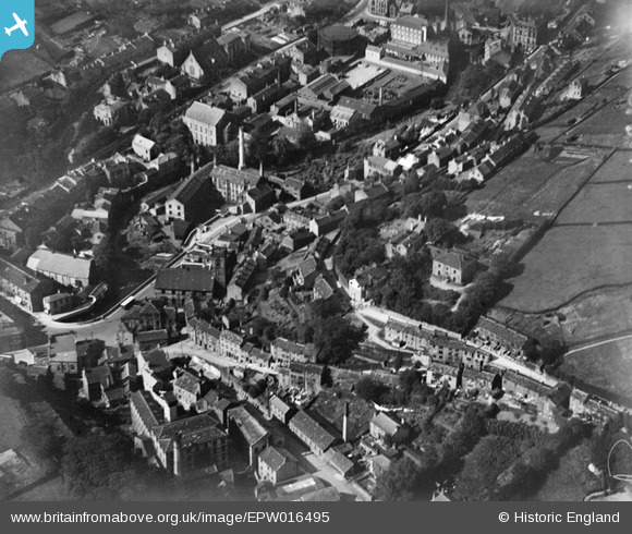
EPW016495 ENGLAND (1926). Holy Trinity Church and the town centre, Holmfirth, 1926
© Copyright OpenStreetMap contributors and licensed by the OpenStreetMap Foundation. 2026. Cartography is licensed as CC BY-SA.
Nearby Images (3)
EPW016495

EPW016499

EPW016494

Details
| Title | [EPW016495] Holy Trinity Church and the town centre, Holmfirth, 1926 |
| Reference | EPW016495 |
| Date | August-1926 |
| Link | |
| Place name | HOLMFIRTH |
| Parish | HOLME VALLEY |
| District | |
| Country | ENGLAND |
| Easting / Northing | 414337, 408223 |
| Longitude / Latitude | -1.7834829523199, 53.570175973314 |
| National Grid Reference | SE143082 |
Pins

John W |
Friday 25th of November 2016 08:19:35 PM |