
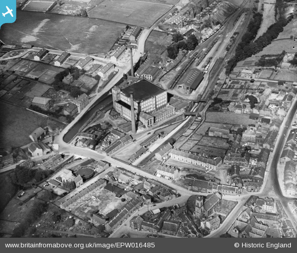
EPW016485 ENGLAND (1926). The town centre and Spinning Mill, Meltham, 1926
© Copyright OpenStreetMap contributors and licensed by the OpenStreetMap Foundation. 2026. Cartography is licensed as CC BY-SA.
Nearby Images (3)
EPW016485

EPW016483

EPW016486

Details
| Title | [EPW016485] The town centre and Spinning Mill, Meltham, 1926 |
| Reference | EPW016485 |
| Date | August-1926 |
| Link | |
| Place name | MELTHAM |
| Parish | MELTHAM |
| District | |
| Country | ENGLAND |
| Easting / Northing | 410019, 410794 |
| Longitude / Latitude | -1.84861043077, 53.593387728089 |
| National Grid Reference | SE100108 |
Pins
Be the first to add a comment to this image!