
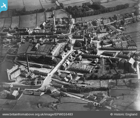
EPW016483 ENGLAND (1926). St Bartholomew's Church and the town centre, Meltham, 1926
© Copyright OpenStreetMap contributors and licensed by the OpenStreetMap Foundation. 2026. Cartography is licensed as CC BY-SA.
Nearby Images (3)
EPW016483

EPW016486

EPW016485

Details
| Title | [EPW016483] St Bartholomew's Church and the town centre, Meltham, 1926 |
| Reference | EPW016483 |
| Date | August-1926 |
| Link | |
| Place name | MELTHAM |
| Parish | MELTHAM |
| District | |
| Country | ENGLAND |
| Easting / Northing | 409929, 410707 |
| Longitude / Latitude | -1.8499731182528, 53.592607372534 |
| National Grid Reference | SE099107 |
Pins
Be the first to add a comment to this image!