
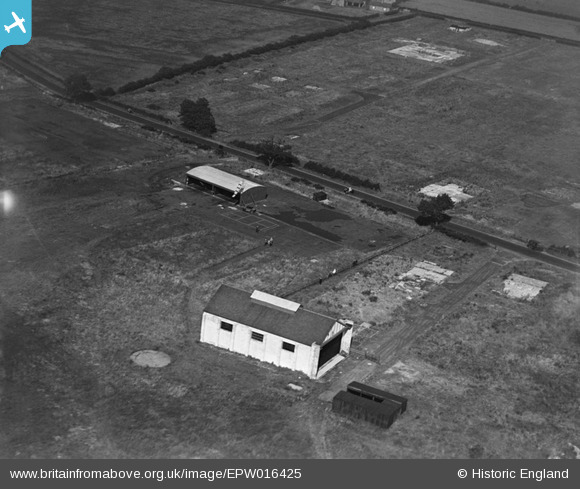
EPW016425 ENGLAND (1926). The aerodrome, Cramlington, 1926
© Copyright OpenStreetMap contributors and licensed by the OpenStreetMap Foundation. 2026. Cartography is licensed as CC BY-SA.
Nearby Images (3)
EPW016425

EPW016424A

EPW016426

Details
| Title | [EPW016425] The aerodrome, Cramlington, 1926 |
| Reference | EPW016425 |
| Date | 29-July-1926 |
| Link | |
| Place name | CRAMLINGTON |
| Parish | CRAMLINGTON |
| District | |
| Country | ENGLAND |
| Easting / Northing | 424351, 577572 |
| Longitude / Latitude | -1.618417828876, 55.091919576427 |
| National Grid Reference | NZ244776 |
Pins
Be the first to add a comment to this image!