
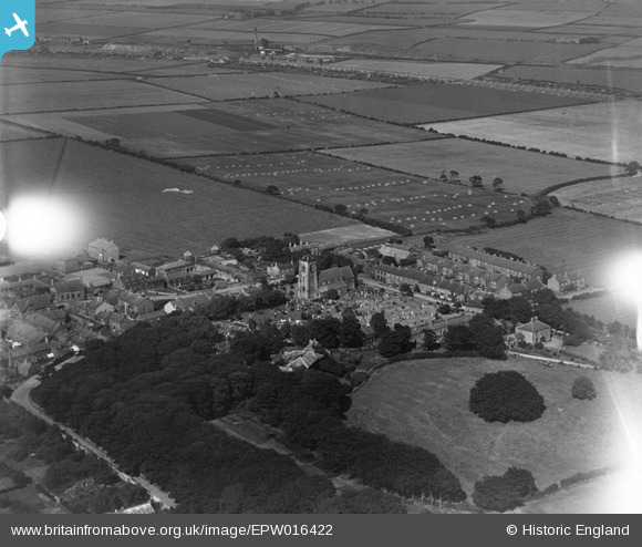
EPW016422 ENGLAND (1926). St Nicholas's Church and the village centre, Cramlington, 1926
© Copyright OpenStreetMap contributors and licensed by the OpenStreetMap Foundation. 2026. Cartography is licensed as CC BY-SA.
Nearby Images (3)
EPW016422

EPW016423

EPW016424

Details
| Title | [EPW016422] St Nicholas's Church and the village centre, Cramlington, 1926 |
| Reference | EPW016422 |
| Date | 29-July-1926 |
| Link | |
| Place name | CRAMLINGTON |
| Parish | CRAMLINGTON |
| District | |
| Country | ENGLAND |
| Easting / Northing | 426766, 576969 |
| Longitude / Latitude | -1.5806323745542, 55.086376094713 |
| National Grid Reference | NZ268770 |
Pins

Sharonkel |
Wednesday 9th of February 2022 02:03:43 PM | |
|
Adam |
Thursday 25th of February 2021 04:39:39 PM | |
|
Adam |
Thursday 25th of February 2021 04:38:46 PM | |
|
Adam |
Thursday 25th of February 2021 04:37:28 PM | |
|
Adam |
Thursday 25th of February 2021 04:36:56 PM | |
|
Adam |
Thursday 25th of February 2021 04:36:01 PM | |
|
John Bruce |
Tuesday 26th of June 2012 10:44:00 AM |