
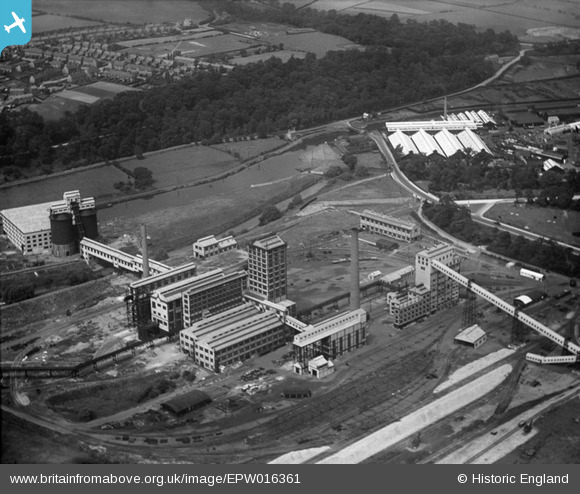
EPW016361 ENGLAND (1926). The Brunner Monds Works, Winnington, 1926
© Copyright OpenStreetMap contributors and licensed by the OpenStreetMap Foundation. 2026. Cartography is licensed as CC BY-SA.
Nearby Images (3)
EPW016361

EPW021584

EPW021583

Details
| Title | [EPW016361] The Brunner Monds Works, Winnington, 1926 |
| Reference | EPW016361 |
| Date | July-1926 |
| Link | |
| Place name | WINNINGTON |
| Parish | NORTHWICH |
| District | |
| Country | ENGLAND |
| Easting / Northing | 364118, 374602 |
| Longitude / Latitude | -2.5380493191425, 53.266919257455 |
| National Grid Reference | SJ641746 |
Pins

J3107 |
Saturday 1st of March 2014 05:08:21 AM | |
|
J3107 |
Saturday 1st of March 2014 05:04:49 AM | |
|
J3107 |
Saturday 1st of March 2014 04:56:48 AM | |
|
J3107 |
Saturday 1st of March 2014 04:52:33 AM | |
|
J3107 |
Saturday 1st of March 2014 04:44:26 AM |
User Comment Contributions
This image is of Wallerscote works, at about the time of its completion in 1926. Part of Winnington works can be seen in the top right. |
Rob |
Saturday 4th of May 2013 08:17:36 PM |