
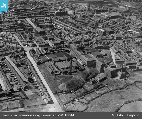
EPW016044 ENGLAND (1926). The Christy and Co. Hillgate Hat Manufactory and environs, Stockport, 1926
© Copyright OpenStreetMap contributors and licensed by the OpenStreetMap Foundation. 2025. Cartography is licensed as CC BY-SA.
Nearby Images (5)
EPW016044

EPW016040

EPW016041

EPW016045

EPW016042

Details
| Title | [EPW016044] The Christy and Co. Hillgate Hat Manufactory and environs, Stockport, 1926 |
| Reference | EPW016044 |
| Date | 2-July-1926 |
| Link | |
| Place name | STOCKPORT |
| Parish | |
| District | |
| Country | ENGLAND |
| Easting / Northing | 389987, 389732 |
| Longitude / Latitude | -2.1506263647935, 53.404052418556 |
| National Grid Reference | SJ900897 |
Pins

Class31 |
Monday 17th of June 2013 09:54:58 AM | |
|
Class31 |
Monday 17th of June 2013 09:54:29 AM | |
|
Class31 |
Monday 17th of June 2013 09:54:08 AM | |
|
Class31 |
Monday 17th of June 2013 09:53:32 AM | |

totoro |
Tuesday 18th of December 2012 10:39:20 PM | |
|
John Ellis |
Wednesday 8th of August 2012 10:50:12 PM | |
|
John Ellis |
Wednesday 8th of August 2012 10:49:14 PM | |
|
John Ellis |
Wednesday 8th of August 2012 10:48:35 PM | |
|
John Ellis |
Wednesday 8th of August 2012 10:46:49 PM | |
|
John Ellis |
Wednesday 8th of August 2012 10:46:15 PM | |
|
John Ellis |
Wednesday 8th of August 2012 10:43:41 PM | |
|
John Ellis |
Wednesday 8th of August 2012 10:43:06 PM |