
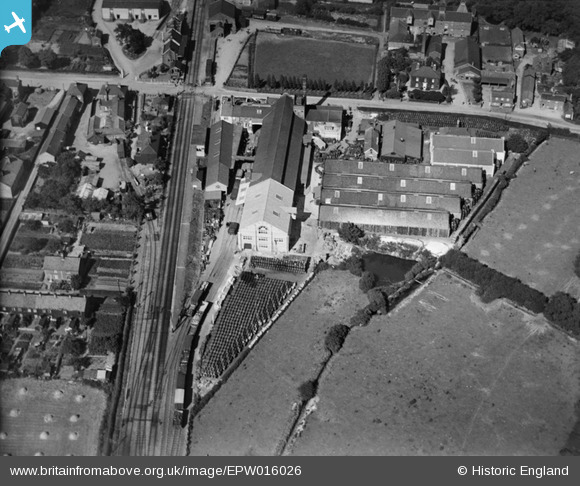
EPW016026 ENGLAND (1926). Gaymers Cider Works, Attleborough, 1926
© Copyright OpenStreetMap contributors and licensed by the OpenStreetMap Foundation. 2025. Cartography is licensed as CC BY-SA.
Nearby Images (14)
EPW016026

EPW016024

EPW039235

EPW016020

EPW016025

EPW016027

EPW016021

EPW016019

EPW039231

EPW039229

EPW039230

EPW016028

EPW016023

EPW016022

Details
| Title | [EPW016026] Gaymers Cider Works, Attleborough, 1926 |
| Reference | EPW016026 |
| Date | 1-July-1926 |
| Link | |
| Place name | ATTLEBOROUGH |
| Parish | ATTLEBOROUGH |
| District | |
| Country | ENGLAND |
| Easting / Northing | 605102, 294904 |
| Longitude / Latitude | 1.022946840389, 52.513003549876 |
| National Grid Reference | TM051949 |
Pins

Class31 |
Wednesday 30th of January 2013 10:07:29 AM |