
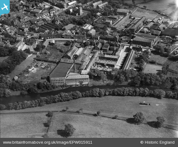
EPW015911 ENGLAND (1926). The Ashfield Iron Foundry, Otley, 1926
© Copyright OpenStreetMap contributors and licensed by the OpenStreetMap Foundation. 2026. Cartography is licensed as CC BY-SA.
Nearby Images (9)
EPW015911

EPW015915

EPW015908

EPW015914

EPW015913

EPW015810

EPW015910

EPW015812

EPW015803

Details
| Title | [EPW015911] The Ashfield Iron Foundry, Otley, 1926 |
| Reference | EPW015911 |
| Date | June-1926 |
| Link | |
| Place name | OTLEY |
| Parish | OTLEY |
| District | |
| Country | ENGLAND |
| Easting / Northing | 419930, 445521 |
| Longitude / Latitude | -1.6966138140919, 53.905264219204 |
| National Grid Reference | SE199455 |
Pins
Be the first to add a comment to this image!