
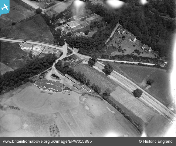
EPW015885 ENGLAND (1926). Croham Hurst Golf Club House and environs, Croham Hurst, 1926
© Copyright OpenStreetMap contributors and licensed by the OpenStreetMap Foundation. 2025. Cartography is licensed as CC BY-SA.
Nearby Images (3)
EPW015885

EPW015882

EPW015888

Details
| Title | [EPW015885] Croham Hurst Golf Club House and environs, Croham Hurst, 1926 |
| Reference | EPW015885 |
| Date | 25-July-1926 |
| Link | |
| Place name | CROHAM HURST |
| Parish | |
| District | |
| Country | ENGLAND |
| Easting / Northing | 533945, 163812 |
| Longitude / Latitude | -0.076058353423547, 51.357068652519 |
| National Grid Reference | TQ339638 |
