
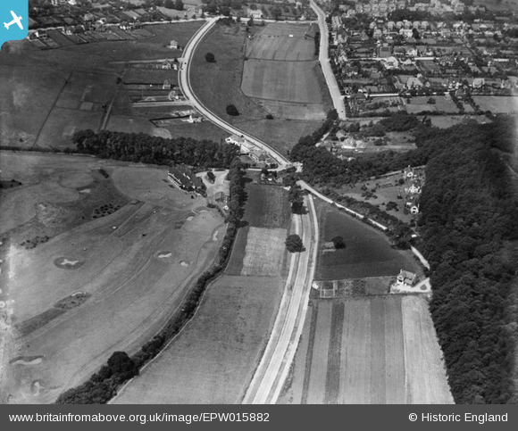
EPW015882 ENGLAND (1926). Croham Hurst Golf Course and Club House and environs, Croham Hurst, 1926
© Copyright OpenStreetMap contributors and licensed by the OpenStreetMap Foundation. 2025. Cartography is licensed as CC BY-SA.
Nearby Images (3)
EPW015882

EPW015885

EPW015888

Details
| Title | [EPW015882] Croham Hurst Golf Course and Club House and environs, Croham Hurst, 1926 |
| Reference | EPW015882 |
| Date | 25-July-1926 |
| Link | |
| Place name | CROHAM HURST |
| Parish | |
| District | |
| Country | ENGLAND |
| Easting / Northing | 533978, 163794 |
| Longitude / Latitude | -0.075591420438766, 51.35689909218 |
| National Grid Reference | TQ340638 |
Pins

Class31 |
Monday 29th of October 2012 08:19:43 PM | |
|
Class31 |
Monday 29th of October 2012 08:19:43 PM | |
|
Class31 |
Monday 29th of October 2012 08:18:36 PM | |
|
Class31 |
Monday 29th of October 2012 08:18:12 PM | |
|
Class31 |
Monday 29th of October 2012 08:17:15 PM | |
|
Class31 |
Monday 29th of October 2012 08:16:47 PM |