
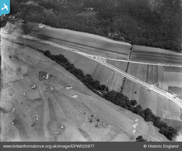
EPW015877 ENGLAND (1926). Croham Hurst Golf Course at the junction of Farley Road and Croham Valley Road, Croham Hurst, 1926
© Copyright OpenStreetMap contributors and licensed by the OpenStreetMap Foundation. 2025. Cartography is licensed as CC BY-SA.
Nearby Images (2)
EPW015877

EPW052488

Details
| Title | [EPW015877] Croham Hurst Golf Course at the junction of Farley Road and Croham Valley Road, Croham Hurst, 1926 |
| Reference | EPW015877 |
| Date | 25-July-1926 |
| Link | |
| Place name | CROHAM HURST |
| Parish | |
| District | |
| Country | ENGLAND |
| Easting / Northing | 534277, 163540 |
| Longitude / Latitude | -0.071395203149632, 51.354545632003 |
| National Grid Reference | TQ343635 |
Pins
Be the first to add a comment to this image!
User Comment Contributions
Wrong-junction of croham valley road and ballards way - note cottage at the top in the woods, which is the pair of old gamekeepers cottages on ballards farm road |

drews |
Tuesday 26th of June 2012 05:49:56 PM |