
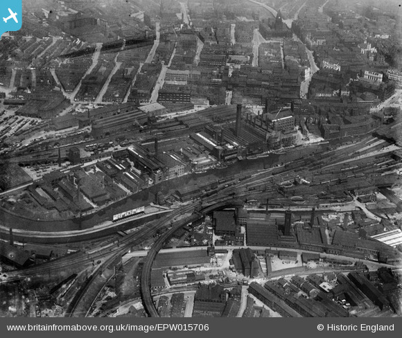
EPW015706 ENGLAND (1926). The Whitehall Soap Works and environs, Leeds, 1926
© Copyright OpenStreetMap contributors and licensed by the OpenStreetMap Foundation. 2026. Cartography is licensed as CC BY-SA.
Nearby Images (11)
EPW015706

EPW015707

EPW015901

EPW015699

EPW015703

EPW015700

EPW015705

EPW015702

EPW015701

EPW015704

EPW050096

Details
| Title | [EPW015706] The Whitehall Soap Works and environs, Leeds, 1926 |
| Reference | EPW015706 |
| Date | May-1926 |
| Link | |
| Place name | LEEDS |
| Parish | |
| District | |
| Country | ENGLAND |
| Easting / Northing | 429474, 433217 |
| Longitude / Latitude | -1.5525147040246, 53.79421279229 |
| National Grid Reference | SE295332 |
Pins

sirdouglas |
Thursday 10th of April 2014 10:17:43 AM | |

Class31 |
Friday 19th of April 2013 10:46:08 PM | |
|
Class31 |
Friday 19th of April 2013 09:29:30 PM | |
|
Class31 |
Friday 19th of April 2013 09:22:21 PM | |
|
Class31 |
Friday 19th of April 2013 09:13:07 PM | |
|
Class31 |
Friday 19th of April 2013 09:07:05 PM | |
|
Class31 |
Friday 19th of April 2013 09:04:15 PM | |
|
Class31 |
Friday 19th of April 2013 09:00:52 PM | |
|
Class31 |
Friday 19th of April 2013 08:43:52 PM |