
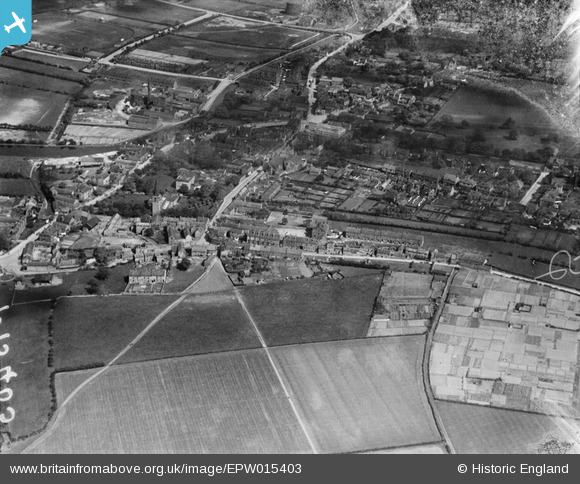
EPW015403 ENGLAND (1926). The Market Place and surroundings, Wath upon Dearne, 1926
© Copyright OpenStreetMap contributors and licensed by the OpenStreetMap Foundation. 2026. Cartography is licensed as CC BY-SA.
Nearby Images (2)
EPW015403

EPW015400

Details
| Title | [EPW015403] The Market Place and surroundings, Wath upon Dearne, 1926 |
| Reference | EPW015403 |
| Date | 3-May-1926 |
| Link | |
| Place name | WATH UPON DEARNE |
| Parish | |
| District | |
| Country | ENGLAND |
| Easting / Northing | 443236, 400767 |
| Longitude / Latitude | -1.3481019022458, 53.501569423396 |
| National Grid Reference | SE432008 |
Pins
Be the first to add a comment to this image!
User Comment Contributions
The old Market Place has particular interest as our first Salvation Army Hall in Wath was established there in 1887 and remained there until around 1950. |

Janet Mulholland |
Monday 9th of July 2012 09:28:16 PM |