
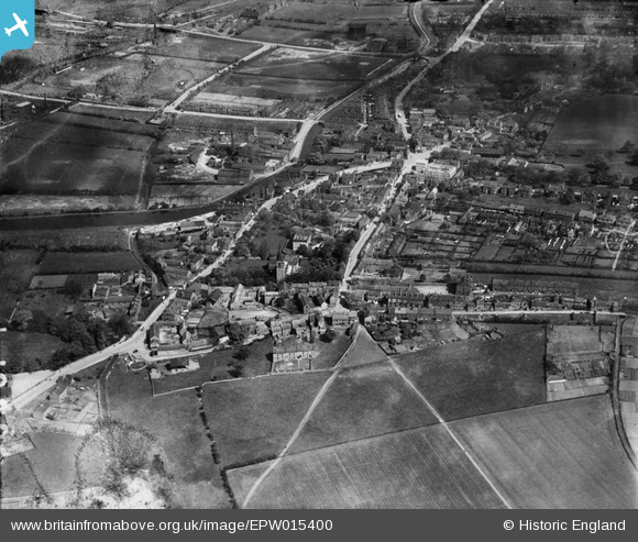
EPW015400 ENGLAND (1926). The town centre, Wath upon Dearne, 1926
© Copyright OpenStreetMap contributors and licensed by the OpenStreetMap Foundation. 2026. Cartography is licensed as CC BY-SA.
Nearby Images (2)
EPW015400

EPW015403

Details
| Title | [EPW015400] The town centre, Wath upon Dearne, 1926 |
| Reference | EPW015400 |
| Date | 3-May-1926 |
| Link | |
| Place name | WATH UPON DEARNE |
| Parish | |
| District | |
| Country | ENGLAND |
| Easting / Northing | 443291, 400867 |
| Longitude / Latitude | -1.3472588815114, 53.502463785985 |
| National Grid Reference | SE433009 |
Pins

W77 |
Wednesday 21st of October 2020 12:38:49 PM | |
|
BoldForester |
Wednesday 18th of July 2012 10:37:46 PM | |
|
BoldForester |
Wednesday 18th of July 2012 10:37:22 PM | |
|
BoldForester |
Wednesday 18th of July 2012 10:37:01 PM | |
|
BoldForester |
Wednesday 18th of July 2012 10:36:14 PM | |
|
BoldForester |
Wednesday 18th of July 2012 10:35:19 PM | |
|
BoldForester |
Wednesday 18th of July 2012 10:34:44 PM | |
|
BoldForester |
Wednesday 18th of July 2012 10:34:08 PM | |
|
BoldForester |
Wednesday 18th of July 2012 10:33:26 PM |