
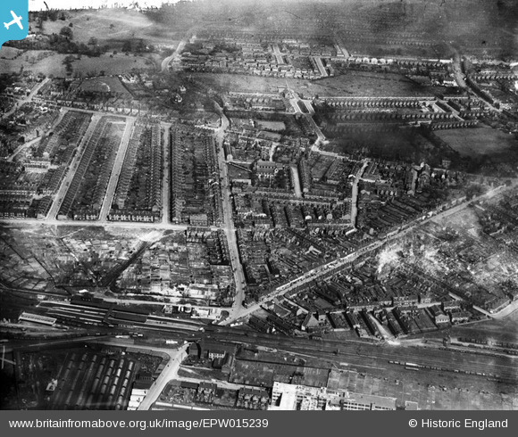
EPW015239 ENGLAND (1926). Crocketts Road and environs, Handsworth, 1926
© Copyright OpenStreetMap contributors and licensed by the OpenStreetMap Foundation. 2026. Cartography is licensed as CC BY-SA.
Nearby Images (9)
EPW015239

EPW015234

EPW015238

EPW015236

EPW015235

EPW015233

EPW015232

EPW015237

EPW015231

Details
| Title | [EPW015239] Crocketts Road and environs, Handsworth, 1926 |
| Reference | EPW015239 |
| Date | 18-April-1926 |
| Link | |
| Place name | HANDSWORTH |
| Parish | |
| District | |
| Country | ENGLAND |
| Easting / Northing | 403561, 289591 |
| Longitude / Latitude | -1.9475325288703, 52.503839377799 |
| National Grid Reference | SP036896 |
Pins

Brummieboy |
Friday 10th of July 2015 02:07:20 PM | |

Class31 |
Wednesday 6th of February 2013 04:23:56 PM | |
|
Class31 |
Wednesday 6th of February 2013 04:23:35 PM | |
|
Class31 |
Wednesday 6th of February 2013 04:23:20 PM | |
|
Mr Pastry |
Monday 2nd of July 2012 08:44:30 PM | |
|
Mr Pastry |
Monday 2nd of July 2012 08:40:23 PM | |
|
Mr Pastry |
Monday 2nd of July 2012 08:37:27 PM | |
|
Mr Pastry |
Monday 2nd of July 2012 08:35:59 PM | |
|
Mr Pastry |
Monday 2nd of July 2012 05:43:13 PM | |
|
Mr Pastry |
Monday 2nd of July 2012 05:40:34 PM | |
|
Mr Pastry |
Monday 2nd of July 2012 05:39:48 PM | |
|
Mr Pastry |
Monday 2nd of July 2012 05:39:14 PM |