
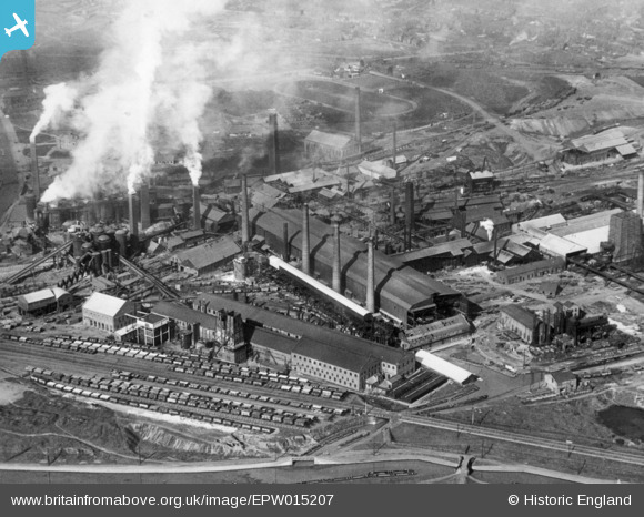
EPW015207 ENGLAND (1926). The Staffordshire Steel and Ingot Iron Works, Bilston, 1926. This image has been produced from a copy-negative.
© Copyright OpenStreetMap contributors and licensed by the OpenStreetMap Foundation. 2026. Cartography is licensed as CC BY-SA.
Nearby Images (2)
EPW015207

EPW015206

Details
| Title | [EPW015207] The Staffordshire Steel and Ingot Iron Works, Bilston, 1926. This image has been produced from a copy-negative. |
| Reference | EPW015207 |
| Date | 13-April-1926 |
| Link | |
| Place name | BILSTON |
| Parish | |
| District | |
| Country | ENGLAND |
| Easting / Northing | 393832, 295716 |
| Longitude / Latitude | -2.0909924970924, 52.558885487973 |
| National Grid Reference | SO938957 |
Pins
Be the first to add a comment to this image!