
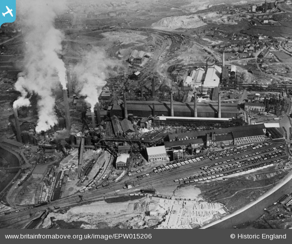
EPW015206 ENGLAND (1926). The Staffordshire Steel and Ingot Iron Works, Bilston, 1926. This image has been produced from a copy-negative.
© Copyright OpenStreetMap contributors and licensed by the OpenStreetMap Foundation. 2026. Cartography is licensed as CC BY-SA.
Nearby Images (2)
EPW015206

EPW015207

Details
| Title | [EPW015206] The Staffordshire Steel and Ingot Iron Works, Bilston, 1926. This image has been produced from a copy-negative. |
| Reference | EPW015206 |
| Date | 13-April-1926 |
| Link | |
| Place name | BILSTON |
| Parish | |
| District | |
| Country | ENGLAND |
| Easting / Northing | 393819, 295763 |
| Longitude / Latitude | -2.091185153517, 52.559307911601 |
| National Grid Reference | SO938958 |
Pins

Andy Edwards |
Thursday 11th of September 2025 05:38:45 PM | |
|
Ian |
Friday 30th of January 2015 04:46:45 PM | |
|
dbm |
Wednesday 17th of December 2014 04:52:23 PM | |
|
dbm |
Wednesday 17th of December 2014 04:51:47 PM |