
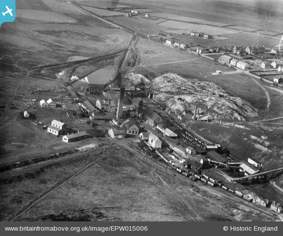
EPW015006 ENGLAND (1926). West Cannock Colliery Pit No 1, Hednesford, 1926
© Copyright OpenStreetMap contributors and licensed by the OpenStreetMap Foundation. 2026. Cartography is licensed as CC BY-SA.
Nearby Images (2)
EPW015006

EPW015004

Details
| Title | [EPW015006] West Cannock Colliery Pit No 1, Hednesford, 1926 |
| Reference | EPW015006 |
| Date | April-1926 |
| Link | |
| Place name | HEDNESFORD |
| Parish | HEDNESFORD |
| District | |
| Country | ENGLAND |
| Easting / Northing | 399230, 313003 |
| Longitude / Latitude | -2.0113996456791, 52.714343330817 |
| National Grid Reference | SJ992130 |
Pins

Pye Green Lad |
Wednesday 6th of January 2016 01:55:15 PM | |
|
Pye Green Lad |
Wednesday 6th of January 2016 01:48:16 PM | |
|
Pye Green Lad |
Wednesday 6th of January 2016 01:34:42 PM | |
|
hednesfordbloke |
Tuesday 30th of December 2014 03:21:50 PM | |
|
hednesfordbloke |
Tuesday 30th of December 2014 03:19:54 PM | |
|
hednesfordbloke |
Tuesday 30th of December 2014 03:19:10 PM | |
|
hednesfordbloke |
Tuesday 30th of December 2014 03:18:02 PM | |
|
sweetpeagrower |
Wednesday 5th of December 2012 10:19:14 PM |