
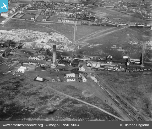
EPW015004 ENGLAND (1926). West Cannock Colliery Pit No 1, Hednesford, 1926
© Copyright OpenStreetMap contributors and licensed by the OpenStreetMap Foundation. 2026. Cartography is licensed as CC BY-SA.
Nearby Images (2)
EPW015004

EPW015006

Details
| Title | [EPW015004] West Cannock Colliery Pit No 1, Hednesford, 1926 |
| Reference | EPW015004 |
| Date | April-1926 |
| Link | |
| Place name | HEDNESFORD |
| Parish | HEDNESFORD |
| District | |
| Country | ENGLAND |
| Easting / Northing | 399204, 312952 |
| Longitude / Latitude | -2.0117844452151, 52.713884769976 |
| National Grid Reference | SJ992130 |
Pins

equinoxe |
Friday 28th of June 2019 01:33:38 PM | |
|
hednesfordbloke |
Tuesday 30th of December 2014 03:28:28 PM | |
|
hednesfordbloke |
Tuesday 30th of December 2014 03:25:03 PM |