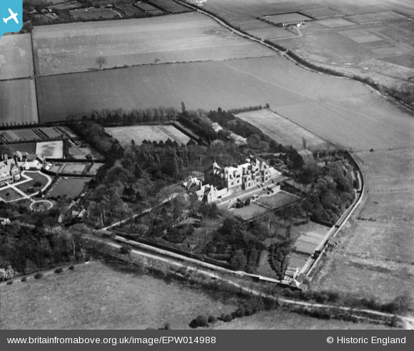
EPW014988 ENGLAND (1926). Mere Hall, Noctorum, 1926
© Copyright OpenStreetMap contributors and licensed by the OpenStreetMap Foundation. 2025. Cartography is licensed as CC BY-SA.
Details
| Title | [EPW014988] Mere Hall, Noctorum, 1926 |
| Reference | EPW014988 |
| Date | 11-April-1926 |
| Link | |
| Place name | NOCTORUM |
| Parish | |
| District | |
| Country | ENGLAND |
| Easting / Northing | 329475, 387544 |
| Longitude / Latitude | -3.0603266625544, 53.379769468918 |
| National Grid Reference | SJ295875 |


![[EPW014988] Mere Hall, Noctorum, 1926](http://britainfromabove.org.uk/sites/all/libraries/aerofilms-images/public/100x100/EPW/014/EPW014988.jpg)
![[EPW014989] Mere Hall, Noctorum, 1926](http://britainfromabove.org.uk/sites/all/libraries/aerofilms-images/public/100x100/EPW/014/EPW014989.jpg)
![[EPW014991] Mere Hall and environs, Noctorum, 1926](http://britainfromabove.org.uk/sites/all/libraries/aerofilms-images/public/100x100/EPW/014/EPW014991.jpg)
![[EPW014990] Mere Hall, Noctorum, 1926](http://britainfromabove.org.uk/sites/all/libraries/aerofilms-images/public/100x100/EPW/014/EPW014990.jpg)
