
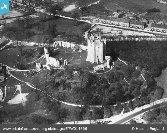
EPW014866 ENGLAND (1926). Conisbrough Castle, Conisbrough, 1926. This image has been produced from a copy-negative.
© Copyright OpenStreetMap contributors and licensed by the OpenStreetMap Foundation. 2026. Cartography is licensed as CC BY-SA.
Nearby Images (8)
EPW014866

EAW005020

EAW005018

EAW005017

EAW005016

EAW005019

EPW014865

EPW014867

Details
| Title | [EPW014866] Conisbrough Castle, Conisbrough, 1926. This image has been produced from a copy-negative. |
| Reference | EPW014866 |
| Date | 5-April-1926 |
| Link | |
| Place name | CONISBROUGH |
| Parish | |
| District | |
| Country | ENGLAND |
| Easting / Northing | 451452, 398892 |
| Longitude / Latitude | -1.2245427730153, 53.483976031053 |
| National Grid Reference | SK515989 |
Pins
Be the first to add a comment to this image!