
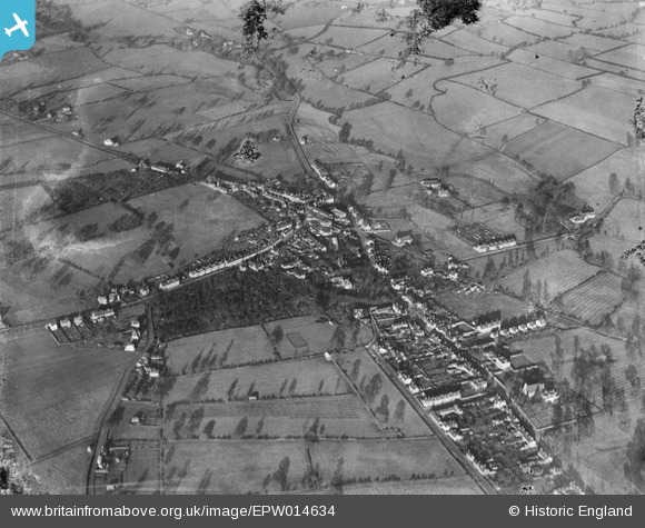
EPW014634 ENGLAND (1925). The village and environs, Studley, from the south-west, 1925
© Copyright OpenStreetMap contributors and licensed by the OpenStreetMap Foundation. 2025. Cartography is licensed as CC BY-SA.
Nearby Images (2)
EPW014634

EPW014632

Details
| Title | [EPW014634] The village and environs, Studley, from the south-west, 1925 |
| Reference | EPW014634 |
| Date | 10-December-1925 |
| Link | |
| Place name | STUDLEY |
| Parish | STUDLEY |
| District | |
| Country | ENGLAND |
| Easting / Northing | 407187, 263671 |
| Longitude / Latitude | -1.8946636104748, 52.270753447462 |
| National Grid Reference | SP072637 |
Pins

Chrissy |
Wednesday 23rd of September 2020 08:31:44 PM |