
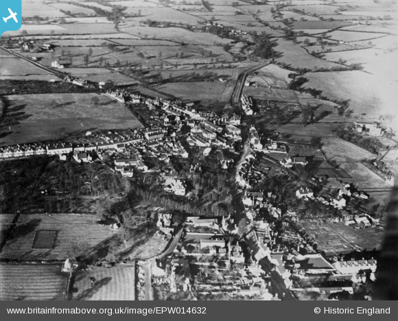
EPW014632 ENGLAND (1925). The village, Studley, from the south, 1925. This image has been produced from a copy-negative.
© Copyright OpenStreetMap contributors and licensed by the OpenStreetMap Foundation. 2025. Cartography is licensed as CC BY-SA.
Nearby Images (3)
EPW014632

EPW014634

EPW014633

Details
| Title | [EPW014632] The village, Studley, from the south, 1925. This image has been produced from a copy-negative. |
| Reference | EPW014632 |
| Date | 10-December-1925 |
| Link | |
| Place name | STUDLEY |
| Parish | STUDLEY |
| District | |
| Country | ENGLAND |
| Easting / Northing | 407281, 263687 |
| Longitude / Latitude | -1.8932855549818, 52.270896071449 |
| National Grid Reference | SP073637 |
Pins
Be the first to add a comment to this image!