
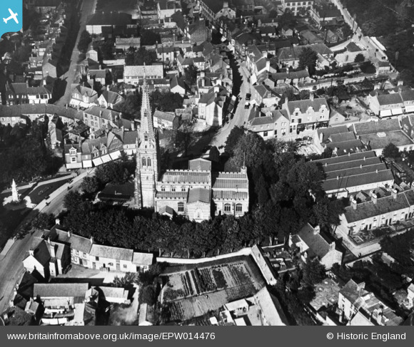
EPW014476 ENGLAND (1925). St Mary's Church, Rushden, 1925. This image has been produced from a copy-negative.
© Copyright OpenStreetMap contributors and licensed by the OpenStreetMap Foundation. 2026. Cartography is licensed as CC BY-SA.
Nearby Images (14)
EPW014476

EAW043190

EAW043186

EAW043187

EAW043185

EAW043189

EAW043192

EAW043188

EAW043183

EAW043191

EAW002829

EAW049225

EAW043184

EAW043182

Details
| Title | [EPW014476] St Mary's Church, Rushden, 1925. This image has been produced from a copy-negative. |
| Reference | EPW014476 |
| Date | October-1925 |
| Link | |
| Place name | RUSHDEN |
| Parish | RUSHDEN |
| District | |
| Country | ENGLAND |
| Easting / Northing | 495770, 266545 |
| Longitude / Latitude | -0.59575601994339, 52.288292908237 |
| National Grid Reference | SP958665 |
