
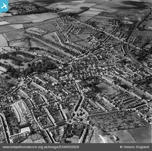
EAW002829 ENGLAND (1946). The town, Rushden, 1946
© Copyright OpenStreetMap contributors and licensed by the OpenStreetMap Foundation. 2026. Cartography is licensed as CC BY-SA.
Nearby Images (14)
EAW002829

EAW049225

EPW014476

EAW043190

EAW043187

EAW043185

EAW043188

EAW043189

EAW043186

EAW043192

EAW043183

EAW043184

EAW043191

EAW043182

Details
| Title | [EAW002829] The town, Rushden, 1946 |
| Reference | EAW002829 |
| Date | 30-September-1946 |
| Link | |
| Place name | RUSHDEN |
| Parish | RUSHDEN |
| District | |
| Country | ENGLAND |
| Easting / Northing | 495717, 266624 |
| Longitude / Latitude | -0.59651044432705, 52.289012243629 |
| National Grid Reference | SP957666 |
Pins

redmist |
Wednesday 9th of November 2022 09:22:21 PM | |
|
EastMarple1 |
Sunday 6th of October 2013 11:44:07 PM |