
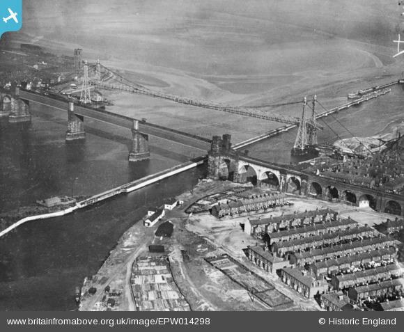
EPW014298 ENGLAND (1925). Runcorn Bridge and the Widnes Transporter Bridge, Runcorn, 1925. This image has been produced from a copy-negative.
© Copyright OpenStreetMap contributors and licensed by the OpenStreetMap Foundation. 2026. Cartography is licensed as CC BY-SA.
Nearby Images (32)
EPW014298

EAW049799

EAW049802

EAW049797

EAW049817

EAW049801

EAW049812

EAW044938

EAW049816

EAW005676

EAW049814

EPW018913

EAW049818

EAW044942

EAW049800

EPW005875

EAW049798

EAW049806

EAW049803

EAW005675

EAW044939

EAW044943

EAW008431

EAW044937

EAW049807

EAW049813

EAW008430

EAW044940

EAW049815

EAW049808

EAW049804

EAW049809

Details
| Title | [EPW014298] Runcorn Bridge and the Widnes Transporter Bridge, Runcorn, 1925. This image has been produced from a copy-negative. |
| Reference | EPW014298 |
| Date | September-1925 |
| Link | |
| Place name | RUNCORN |
| Parish | |
| District | |
| Country | ENGLAND |
| Easting / Northing | 350888, 383382 |
| Longitude / Latitude | -2.7377764218801, 53.344782688222 |
| National Grid Reference | SJ509834 |
