
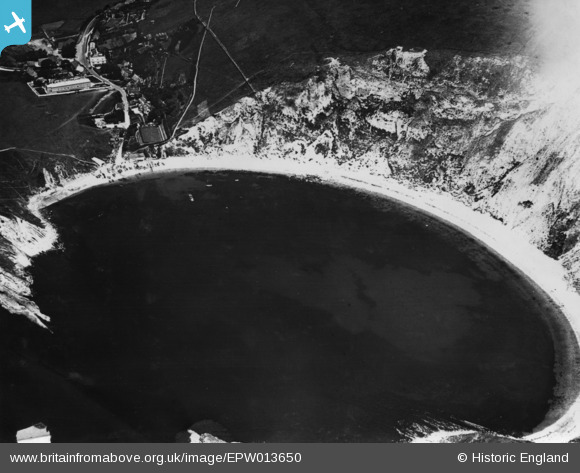
EPW013650 ENGLAND (1925). Lulworth Cove, West Lulworth, 1925. This image has been produced from a print.
© Copyright OpenStreetMap contributors and licensed by the OpenStreetMap Foundation. 2026. Cartography is licensed as CC BY-SA.
Nearby Images (10)
EPW013650

EAW002989

EAW035600

EAW049040

EPW013653

EAW035599

EAW049041

EPW013652

EAW049039

EAW049042

Details
| Title | [EPW013650] Lulworth Cove, West Lulworth, 1925. This image has been produced from a print. |
| Reference | EPW013650 |
| Date | June-1925 |
| Link | |
| Place name | WEST LULWORTH |
| Parish | WEST LULWORTH |
| District | |
| Country | ENGLAND |
| Easting / Northing | 382604, 79939 |
| Longitude / Latitude | -2.2459253396929, 50.618313723308 |
| National Grid Reference | SY826799 |
Pins
Be the first to add a comment to this image!