
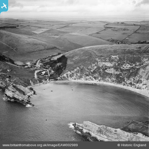
EAW002989 ENGLAND (1946). Wave diffraction, Lulworth Cove, from the south-east, 1946
© Copyright OpenStreetMap contributors and licensed by the OpenStreetMap Foundation. 2026. Cartography is licensed as CC BY-SA.
Nearby Images (9)
EAW002989

EPW013650

EPW013653

EAW049040

EAW049041

EAW035600

EAW035599

EPW013652

EAW049039

Details
| Title | [EAW002989] Wave diffraction, Lulworth Cove, from the south-east, 1946 |
| Reference | EAW002989 |
| Date | 3-October-1946 |
| Link | |
| Place name | LULWORTH COVE |
| Parish | WEST LULWORTH |
| District | |
| Country | ENGLAND |
| Easting / Northing | 382564, 79917 |
| Longitude / Latitude | -2.2464897755498, 50.618114665186 |
| National Grid Reference | SY826799 |
Pins

Matt Aldred edob.mattaldred.com |
Thursday 12th of November 2020 08:55:33 PM | |
|
Matt Aldred edob.mattaldred.com |
Thursday 12th of November 2020 08:54:56 PM | |
|
Matt Aldred edob.mattaldred.com |
Thursday 12th of November 2020 08:54:41 PM | |

cptpies |
Wednesday 15th of January 2014 03:55:21 PM | |
|
Al |
Monday 6th of January 2014 01:16:55 AM | |
|
Al |
Monday 6th of January 2014 01:13:46 AM | |
|
Al |
Monday 6th of January 2014 01:13:15 AM |
User Comment Contributions

Unrecorded pillbox and anti tank blocks. |
cptpies |
Wednesday 15th of January 2014 03:58:39 PM |