
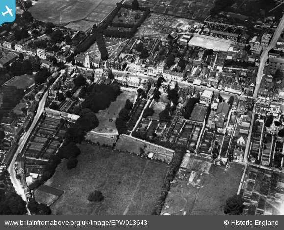
EPW013643 ENGLAND (1925). The High Street, Lymington, 1925. This image has been produced from a print.
© Copyright OpenStreetMap contributors and licensed by the OpenStreetMap Foundation. 2026. Cartography is licensed as CC BY-SA.
Nearby Images (6)
EPW013643

EAW043399

EAW018163

EPW022941

EPW022934

EAW018162

Details
| Title | [EPW013643] The High Street, Lymington, 1925. This image has been produced from a print. |
| Reference | EPW013643 |
| Date | June-1925 |
| Link | |
| Place name | LYMINGTON |
| Parish | LYMINGTON AND PENNINGTON |
| District | |
| Country | ENGLAND |
| Easting / Northing | 432312, 95412 |
| Longitude / Latitude | -1.5418610937804, 50.756833865916 |
| National Grid Reference | SZ323954 |
Pins
Be the first to add a comment to this image!