
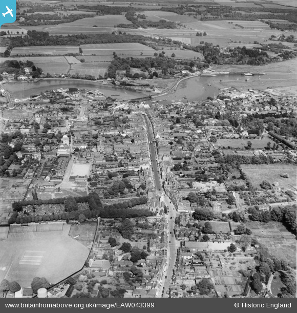
EAW043399 ENGLAND (1952). The town centre, Lymington, 1952
© Copyright OpenStreetMap contributors and licensed by the OpenStreetMap Foundation. 2026. Cartography is licensed as CC BY-SA.
Nearby Images (5)
EAW043399

EPW013643

EPW022941

EAW018162

EAW018163

Details
| Title | [EAW043399] The town centre, Lymington, 1952 |
| Reference | EAW043399 |
| Date | 23-May-1952 |
| Link | |
| Place name | LYMINGTON |
| Parish | LYMINGTON AND PENNINGTON |
| District | |
| Country | ENGLAND |
| Easting / Northing | 432350, 95509 |
| Longitude / Latitude | -1.5413137983659, 50.757704104508 |
| National Grid Reference | SZ324955 |
Pins
Be the first to add a comment to this image!