
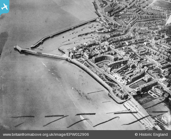
EPW012906 ENGLAND (1925). The Harbour, Royal Prince's Parade and environs, Bridlington, 1925. This image has been produced from a copy-negative marked by Aerofilms Ltd for photo editing.
© Copyright OpenStreetMap contributors and licensed by the OpenStreetMap Foundation. 2026. Cartography is licensed as CC BY-SA.
Nearby Images (9)
EPW012906

EPW023155

EPW023154

EPW023142

EAW013983

EAW013985

EAW013982

EPW039059

EPW039060

Details
| Title | [EPW012906] The Harbour, Royal Prince's Parade and environs, Bridlington, 1925. This image has been produced from a copy-negative marked by Aerofilms Ltd for photo editing. |
| Reference | EPW012906 |
| Date | 22-May-1925 |
| Link | |
| Place name | BRIDLINGTON |
| Parish | BRIDLINGTON |
| District | |
| Country | ENGLAND |
| Easting / Northing | 518696, 466644 |
| Longitude / Latitude | -0.18538728798474, 54.081831523128 |
| National Grid Reference | TA187666 |
Pins
Be the first to add a comment to this image!