
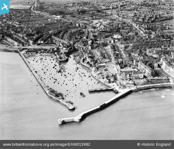
EAW013982 ENGLAND (1948). The harbour and town, Bridlington, 1948. This image has been produced from a damaged negative.
© Copyright OpenStreetMap contributors and licensed by the OpenStreetMap Foundation. 2026. Cartography is licensed as CC BY-SA.
Nearby Images (8)
EAW013982

EAW013985

EAW013983

EPW023154

EPW012906

EPW023155

EPW023142

EAW013984

Details
| Title | [EAW013982] The harbour and town, Bridlington, 1948. This image has been produced from a damaged negative. |
| Reference | EAW013982 |
| Date | 23-March-1948 |
| Link | |
| Place name | BRIDLINGTON |
| Parish | BRIDLINGTON |
| District | |
| Country | ENGLAND |
| Easting / Northing | 518513, 466546 |
| Longitude / Latitude | -0.1882217869497, 54.080993232931 |
| National Grid Reference | TA185665 |
Pins

Sprattlebeam |
Thursday 13th of December 2018 05:13:03 PM | |
|
Sprattlebeam |
Thursday 13th of December 2018 04:45:40 PM | |
|
Sprattlebeam |
Thursday 13th of December 2018 04:45:05 PM | |
|
Sprattlebeam |
Thursday 13th of December 2018 04:44:07 PM | |
|
Al |
Thursday 1st of February 2018 07:41:08 PM | |
|
Giddo |
Monday 6th of June 2016 01:31:55 PM | |
|
Giddo |
Monday 6th of June 2016 01:31:50 PM | |
|
ken |
Sunday 14th of June 2015 07:27:53 PM | |
|
ken |
Sunday 14th of June 2015 07:26:36 PM | |
|
ken |
Sunday 14th of June 2015 07:19:27 PM | |
|
Philip |
Friday 24th of October 2014 11:26:48 PM | |
|
Philip |
Friday 24th of October 2014 11:19:02 PM |