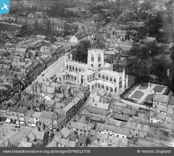
EPW012708 ENGLAND (1925). St Mary's Church and environs, Beverley, 1925
© Copyright OpenStreetMap contributors and licensed by the OpenStreetMap Foundation. 2025. Cartography is licensed as CC BY-SA.
Nearby Images (6)
Details
| Title | [EPW012708] St Mary's Church and environs, Beverley, 1925 |
| Reference | EPW012708 |
| Date | 6-May-1925 |
| Link | |
| Place name | BEVERLEY |
| Parish | BEVERLEY |
| District | |
| Country | ENGLAND |
| Easting / Northing | 503163, 439787 |
| Longitude / Latitude | -0.4318338728875, 53.843857794771 |
| National Grid Reference | TA032398 |
Pins
 Mark |
Wednesday 4th of March 2020 10:10:01 PM | |
 John Wass |
Wednesday 26th of October 2016 03:45:27 PM |


![[EPW012708] St Mary's Church and environs, Beverley, 1925](http://britainfromabove.org.uk/sites/all/libraries/aerofilms-images/public/100x100/EPW/012/EPW012708.jpg)
![[EPW023160] St Mary's Church and surroundings, Beverley, 1928](http://britainfromabove.org.uk/sites/all/libraries/aerofilms-images/public/100x100/EPW/023/EPW023160.jpg)
![[EPW012709] St Mary's Church, Beverley, 1925](http://britainfromabove.org.uk/sites/all/libraries/aerofilms-images/public/100x100/EPW/012/EPW012709.jpg)
![[EPW012707] St Mary's Church, Beverley, 1925](http://britainfromabove.org.uk/sites/all/libraries/aerofilms-images/public/100x100/EPW/012/EPW012707.jpg)
![[EPW012705] North Bar Within and St Mary's Church, Beverley, 1925](http://britainfromabove.org.uk/sites/all/libraries/aerofilms-images/public/100x100/EPW/012/EPW012705.jpg)
![[EPW012706] The Market Place and St Mary's Church, Beverley, 1925](http://britainfromabove.org.uk/sites/all/libraries/aerofilms-images/public/100x100/EPW/012/EPW012706.jpg)