
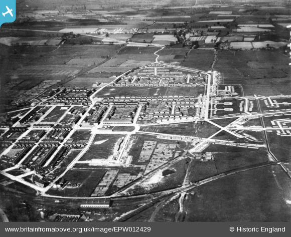
EPW012429 ENGLAND (1925). Civic Square and the surrounding residential area under construction, Tilbury, 1925. This image has been produced from a copy-negative.
© Copyright OpenStreetMap contributors and licensed by the OpenStreetMap Foundation. 2026. Cartography is licensed as CC BY-SA.
Nearby Images (5)
EPW012429

EAW048232

EAW048228

EAW048223

EAW048226

Details
| Title | [EPW012429] Civic Square and the surrounding residential area under construction, Tilbury, 1925. This image has been produced from a copy-negative. |
| Reference | EPW012429 |
| Date | 18-March-1925 |
| Link | |
| Place name | TILBURY |
| Parish | |
| District | |
| Country | ENGLAND |
| Easting / Northing | 564481, 176455 |
| Longitude / Latitude | 0.36805077116502, 51.462645806986 |
| National Grid Reference | TQ645765 |
Pins

Blifster |
Tuesday 21st of April 2015 10:14:25 PM | |
|
Blifster |
Tuesday 21st of April 2015 10:13:21 PM | |
|
Blifster |
Tuesday 21st of April 2015 10:12:49 PM | |
|
Blifster |
Tuesday 21st of April 2015 10:12:12 PM | |
|
Blifster |
Tuesday 21st of April 2015 10:11:45 PM |