
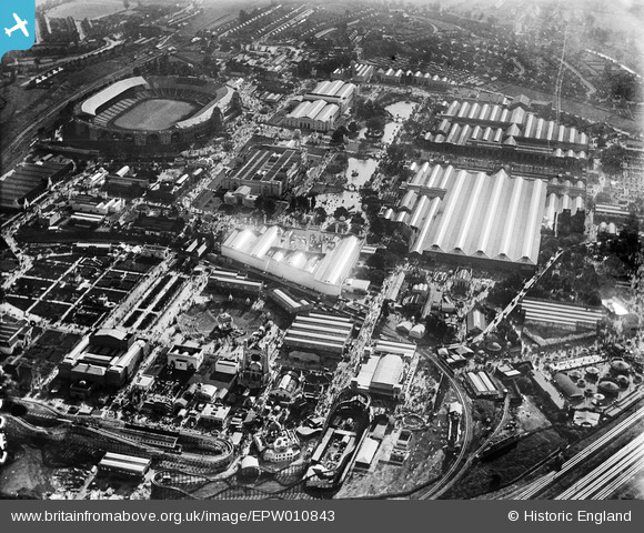
EPW010843 ENGLAND (1924). The British Empire Exhibition, Wembley Park, 1924
© Copyright OpenStreetMap contributors and licensed by the OpenStreetMap Foundation. 2026. Cartography is licensed as CC BY-SA.
Nearby Images (18)
EPW010843

EPW009543

EPW009669

EAW026797

EPW009671

EPW025121

EPW010847

EPW011387

EPW010737

EPW011385

EPW020861

EPW012753

EPW009651

EPW009653

EPW009672

EPW010845

EPW010846

EPW008721

Details
| Title | [EPW010843] The British Empire Exhibition, Wembley Park, 1924 |
| Reference | EPW010843 |
| Date | June-1924 |
| Link | |
| Place name | WEMBLEY PARK |
| Parish | |
| District | |
| Country | ENGLAND |
| Easting / Northing | 519719, 185822 |
| Longitude / Latitude | -0.27283803133675, 51.558082187571 |
| National Grid Reference | TQ197858 |
Pins

The Laird |
Saturday 18th of February 2023 04:54:01 PM | |
|
The Laird |
Saturday 18th of February 2023 04:31:17 PM | |
|
The Laird |
Saturday 18th of February 2023 04:26:13 PM |