
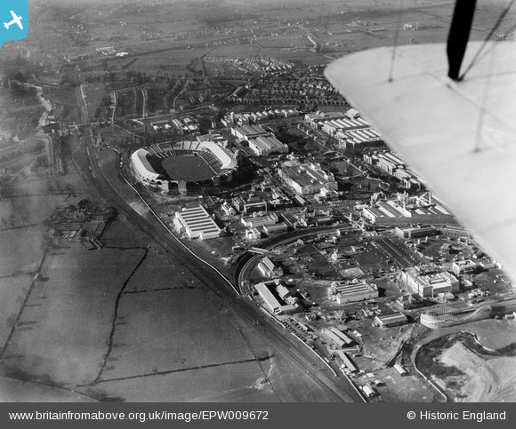
EPW009672 ENGLAND (1923). The British Empire Exhibition site, Wembley Park, 1923
© Copyright OpenStreetMap contributors and licensed by the OpenStreetMap Foundation. 2026. Cartography is licensed as CC BY-SA.
Nearby Images (46)
EPW009672

EPW009651

EPW009653

EPW010845

EPW010844

EPW010737

EPW010846

EPW009671

EPW010847

EPW009544

EPW009670

EPW017631

EPW022716

EPW035050

EPW040770

EPW011413

EPW009546

EPW009669

EPW010726

EPW008279
 and site under construction, Wembley Park, 1923. This image has been produced from a copy-negative.")
EPW017629

EPW026436

EAW048874

EPW011411

EPW010843

EPW020869

EPW011385

EPW015322

EPW017634

EPW017628

EPW017633

EPW031457

EPW009543

EPW010454

EPW012731

EPW017637

EPW020866

EPW025121

EPW010736

EPW020861

EPW020342

EPW020342
EPW017627

EPW046911

EPW022717

EPW010842

Details
| Title | [EPW009672] The British Empire Exhibition site, Wembley Park, 1923 |
| Reference | EPW009672 |
| Date | 1923 |
| Link | |
| Place name | WEMBLEY PARK |
| Parish | |
| District | |
| Country | ENGLAND |
| Easting / Northing | 519636, 185591 |
| Longitude / Latitude | -0.27411348104094, 51.55602349541 |
| National Grid Reference | TQ196856 |
Pins
Be the first to add a comment to this image!
User Comment Contributions

And again... |

James Crawford |
Tuesday 30th of July 2013 11:49:14 AM |