
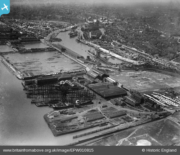
EPW010815 ENGLAND (1924). Victoria Dock, the Timber Ponds and Earle's Shipbuilding and Engineering Yard, Kingston upon Hull, 1924
© Copyright OpenStreetMap contributors and licensed by the OpenStreetMap Foundation. 2026. Cartography is licensed as CC BY-SA.
Nearby Images (4)
EPW010815

EPW010811

EAW015639

EAW015660

Details
| Title | [EPW010815] Victoria Dock, the Timber Ponds and Earle's Shipbuilding and Engineering Yard, Kingston upon Hull, 1924 |
| Reference | EPW010815 |
| Date | June-1924 |
| Link | |
| Place name | KINGSTON UPON HULL |
| Parish | |
| District | |
| Country | ENGLAND |
| Easting / Northing | 511337, 428747 |
| Longitude / Latitude | -0.3116288844521, 53.742974460653 |
| National Grid Reference | TA113287 |
Pins

incony |
Wednesday 26th of October 2022 01:51:27 PM | |
|
John Wass |
Monday 10th of November 2014 11:51:58 AM |