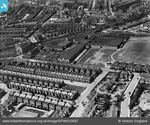
EPW010687 ENGLAND (1924). The Wilkinson Sword Oakley Works, Acton, 1924
© Copyright OpenStreetMap contributors and licensed by the OpenStreetMap Foundation. 2026. Cartography is licensed as CC BY-SA.
Nearby Images (10)
Details
| Title | [EPW010687] The Wilkinson Sword Oakley Works, Acton, 1924 |
| Reference | EPW010687 |
| Date | 21-June-1924 |
| Link | |
| Place name | ACTON |
| Parish | |
| District | |
| Country | ENGLAND |
| Easting / Northing | 520587, 179641 |
| Longitude / Latitude | -0.26243860502771, 51.502340472214 |
| National Grid Reference | TQ206796 |
Pins

Leslie B |
Saturday 30th of July 2022 09:27:05 PM | |

Leslie B |
Saturday 30th of July 2022 09:23:02 PM | |

Leslie B |
Saturday 30th of July 2022 09:20:03 PM | |

Leslie B |
Saturday 30th of July 2022 09:19:46 PM | |

Leslie B |
Saturday 30th of July 2022 09:19:03 PM | |

houds |
Friday 30th of January 2015 05:21:00 PM |


![[EPW010687] The Wilkinson Sword Oakley Works, Acton, 1924](http://britainfromabove.org.uk/sites/all/libraries/aerofilms-images/public/100x100/EPW/010/EPW010687.jpg)
![[EPW010688] View of Acton and the Wilkinson Sword Oakley Works, Acton, from the east, 1924](http://britainfromabove.org.uk/sites/all/libraries/aerofilms-images/public/100x100/EPW/010/EPW010688.jpg)
![[EPW007635] The Augener Works and environs, Acton, 1922](http://britainfromabove.org.uk/sites/all/libraries/aerofilms-images/public/100x100/EPW/007/EPW007635.jpg)
![[EPW007639] The Augener Works, Acton, 1922](http://britainfromabove.org.uk/sites/all/libraries/aerofilms-images/public/100x100/EPW/007/EPW007639.jpg)
![[EPW007636] The Augener Works and environs, Acton, 1922](http://britainfromabove.org.uk/sites/all/libraries/aerofilms-images/public/100x100/EPW/007/EPW007636.jpg)
![[EPW007637] The Augener Works, Acton, 1922](http://britainfromabove.org.uk/sites/all/libraries/aerofilms-images/public/100x100/EPW/007/EPW007637.jpg)
![[EPW007638] The Augener Works, Acton, 1922](http://britainfromabove.org.uk/sites/all/libraries/aerofilms-images/public/100x100/EPW/007/EPW007638.jpg)
![[EPW010692] The Wilkinson Sword Oakley Works and environs, Acton, 1924](http://britainfromabove.org.uk/sites/all/libraries/aerofilms-images/public/100x100/EPW/010/EPW010692.jpg)
![[EPW006169] Engineering Works beside Action Park, Acton, from the south-west, 1921](http://britainfromabove.org.uk/sites/all/libraries/aerofilms-images/public/100x100/EPW/006/EPW006169.jpg)
![[EPW056249] Eastman's Dyeing and Cleaning Works and environs, Acton, 1938](http://britainfromabove.org.uk/sites/all/libraries/aerofilms-images/public/100x100/EPW/056/EPW056249.jpg)