
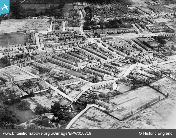
EPW010318 ENGLAND (1924). Brigadier Hill and environs, Enfield, 1924. This image has been produced from a copy-negative.
© Copyright OpenStreetMap contributors and licensed by the OpenStreetMap Foundation. 2026. Cartography is licensed as CC BY-SA.
Nearby Images (2)
EPW010318

EPW010317

Details
| Title | [EPW010318] Brigadier Hill and environs, Enfield, 1924. This image has been produced from a copy-negative. |
| Reference | EPW010318 |
| Date | April-1924 |
| Link | |
| Place name | ENFIELD |
| Parish | |
| District | |
| Country | ENGLAND |
| Easting / Northing | 532540, 198002 |
| Longitude / Latitude | -0.083371612669857, 51.664680444802 |
| National Grid Reference | TQ325980 |
Pins

Stevo |
Sunday 4th of February 2018 07:45:54 PM | |
|
Stuart Trubee |
Tuesday 2nd of September 2014 11:09:50 PM | |
|
Stuart Trubee |
Tuesday 2nd of September 2014 11:09:07 PM |