
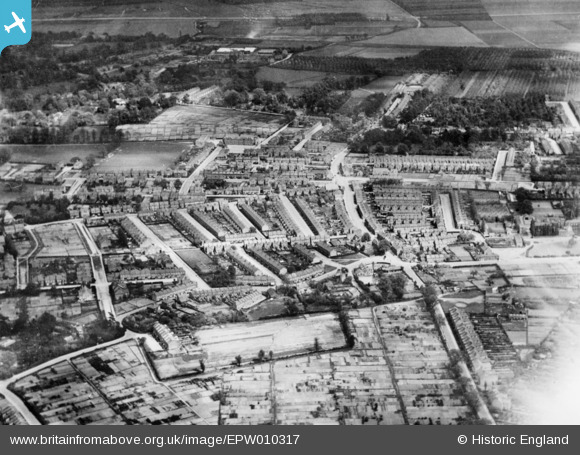
EPW010317 ENGLAND (1924). Lancaster Road and environs, Enfield, 1924. This image has been produced from a copy-negative.
© Copyright OpenStreetMap contributors and licensed by the OpenStreetMap Foundation. 2026. Cartography is licensed as CC BY-SA.
Nearby Images (2)
EPW010317

EPW010318

Details
| Title | [EPW010317] Lancaster Road and environs, Enfield, 1924. This image has been produced from a copy-negative. |
| Reference | EPW010317 |
| Date | April-1924 |
| Link | |
| Place name | ENFIELD |
| Parish | |
| District | |
| Country | ENGLAND |
| Easting / Northing | 532611, 197944 |
| Longitude / Latitude | -0.082367532321573, 51.664142432666 |
| National Grid Reference | TQ326979 |
Pins

sipickles |
Sunday 25th of August 2024 09:39:22 AM | |
|
sipickles |
Sunday 25th of August 2024 09:38:04 AM | |
|
sipickles |
Sunday 25th of August 2024 09:36:31 AM | |
|
Nick K |
Tuesday 22nd of March 2022 10:15:13 AM | |
|
RandomHarvest |
Friday 23rd of October 2020 04:57:57 AM | |
|
Macmartyn |
Friday 28th of November 2014 04:46:25 PM | |
|
Macmartyn |
Friday 28th of November 2014 04:45:22 PM | |
|
Grk |
Monday 1st of September 2014 08:00:26 PM | |
|
Grk |
Monday 1st of September 2014 07:57:29 PM |