
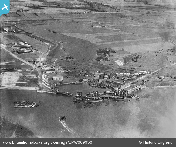
EPW009950 ENGLAND (1924). Dagenham Dock, Dagenham, 1924
© Copyright OpenStreetMap contributors and licensed by the OpenStreetMap Foundation. 2026. Cartography is licensed as CC BY-SA.
Nearby Images (18)
EPW009950

EPW009945

EPW010924

EAW031157

EAW031152

EAW031151

EAW031149

EAW031153

EPW059967

EAW031150

EPW059966

EPW021397

EPW059963

EPW059962

EPW021392

EPW009951

EPW059964

EPW059965

Details
| Title | [EPW009950] Dagenham Dock, Dagenham, 1924 |
| Reference | EPW009950 |
| Date | March-1924 |
| Link | |
| Place name | DAGENHAM |
| Parish | |
| District | |
| Country | ENGLAND |
| Easting / Northing | 549032, 181857 |
| Longitude / Latitude | 0.14808743066934, 51.515468832666 |
| National Grid Reference | TQ490819 |
Pins
Be the first to add a comment to this image!