
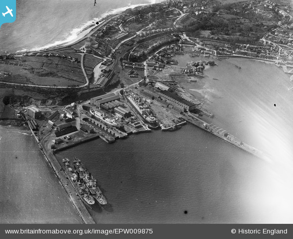
EPW009875 ENGLAND (1924). The Outer Harbour, docks and Iron Foundry, Falmouth, 1924
© Copyright OpenStreetMap contributors and licensed by the OpenStreetMap Foundation. 2026. Cartography is licensed as CC BY-SA.
Nearby Images (34)
EPW009875

EPW023171

EPW021715

EPW009879

EPW021720

EPW009874

EPW023359

EPW009877

EPW023355

EPW023358

EPW045674

EPW023349

EPW023347

EPW021718

EPW023350

EPW023352

EPW009878

EPW009876

EPW021713

EPW023357

EPW055835

EPW021712

EPW021714

EPW055832

EPW021717

EPW023371

EPW045677

EPW023356

EPW055834

EPW021716

EPW045672

EPW055833

EAW033625

EAW030927

Details
| Title | [EPW009875] The Outer Harbour, docks and Iron Foundry, Falmouth, 1924 |
| Reference | EPW009875 |
| Date | March-1924 |
| Link | |
| Place name | FALMOUTH |
| Parish | FALMOUTH |
| District | |
| Country | ENGLAND |
| Easting / Northing | 181886, 32568 |
| Longitude / Latitude | -5.0536428692534, 50.15235441751 |
| National Grid Reference | SW819326 |
Pins
Be the first to add a comment to this image!