
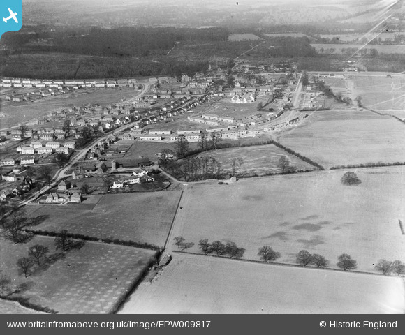
EPW009817 ENGLAND (1924). Queens Road and Lower Handside Farm, Welwyn Garden City, from the south, 1924
© Copyright OpenStreetMap contributors and licensed by the OpenStreetMap Foundation. 2026. Cartography is licensed as CC BY-SA.
Nearby Images (10)
EPW009817

EPW047378

EAW041977

EPW047375

EPW054509

EAW035462

EPW054495

EPW013426

EAW013998

EPW009815

Details
| Title | [EPW009817] Queens Road and Lower Handside Farm, Welwyn Garden City, from the south, 1924 |
| Reference | EPW009817 |
| Date | March-1924 |
| Link | |
| Place name | WELWYN GARDEN CITY |
| Parish | |
| District | |
| Country | ENGLAND |
| Easting / Northing | 523262, 212384 |
| Longitude / Latitude | -0.21237224256722, 51.796054970978 |
| National Grid Reference | TL233124 |
Pins
Be the first to add a comment to this image!
User Comment Contributions
a mistranscription - the road is Guessens, not Queens |

David Robertson |
Sunday 10th of November 2013 07:10:08 PM |