
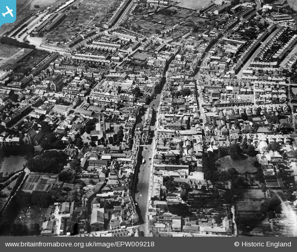
EPW009218 ENGLAND (1923). The High Street and environs, Ashford, 1923
© Copyright OpenStreetMap contributors and licensed by the OpenStreetMap Foundation. 2026. Cartography is licensed as CC BY-SA.
Nearby Images (14)
EPW009218

EPW026096

EPW026091

EPW026100

EPW009142

EPW000710

EPW026089

EPW001440

EPW026086

EPW007035

EPW009217

EAW026215

EPW041208

EAW013658

Details
| Title | [EPW009218] The High Street and environs, Ashford, 1923 |
| Reference | EPW009218 |
| Date | 1923 |
| Link | |
| Place name | ASHFORD |
| Parish | |
| District | |
| Country | ENGLAND |
| Easting / Northing | 600996, 142808 |
| Longitude / Latitude | 0.87415558514664, 51.148660668776 |
| National Grid Reference | TR010428 |
Pins

Kent Navigator |
Wednesday 4th of October 2017 02:57:56 PM | |
|
Kent Navigator |
Wednesday 4th of October 2017 02:47:58 PM | |
|
Kent Navigator |
Wednesday 4th of October 2017 02:39:59 PM | |
|
Kent Navigator |
Wednesday 4th of October 2017 02:37:49 PM | |
|
Kent Navigator |
Wednesday 4th of October 2017 02:36:26 PM |