
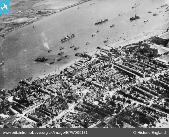
EPW009131 ENGLAND (1923). The town centre, Gravesend, 1923. This image has been produced from a copy-negative.
© Copyright OpenStreetMap contributors and licensed by the OpenStreetMap Foundation. 2026. Cartography is licensed as CC BY-SA.
Nearby Images (5)
EPW009131

EPW009132

EPW009133

EPW001413

EPW001414

Details
| Title | [EPW009131] The town centre, Gravesend, 1923. This image has been produced from a copy-negative. |
| Reference | EPW009131 |
| Date | 1923 |
| Link | |
| Place name | GRAVESEND |
| Parish | |
| District | |
| Country | ENGLAND |
| Easting / Northing | 565027, 174394 |
| Longitude / Latitude | 0.37494274169923, 51.443969094479 |
| National Grid Reference | TQ650744 |
Pins

conrat4567 |
Monday 20th of February 2023 12:46:16 PM | |
|
conrat4567 |
Tuesday 31st of January 2023 02:29:29 PM | |
|
adrianmc |
Thursday 18th of February 2021 09:33:35 AM | |
|
adrianmc |
Thursday 18th of February 2021 09:33:16 AM | |
|
adrianmc |
Thursday 18th of February 2021 09:32:53 AM | |
|
Prospector |
Sunday 13th of September 2020 11:39:42 PM | |
|
Kentishman |
Saturday 6th of August 2016 09:26:48 PM | |
|
jayneB |
Tuesday 3rd of May 2016 05:08:28 PM | |
|
jayneB |
Tuesday 3rd of May 2016 05:07:31 PM | |
|
jayneB |
Tuesday 3rd of May 2016 05:06:48 PM |
