
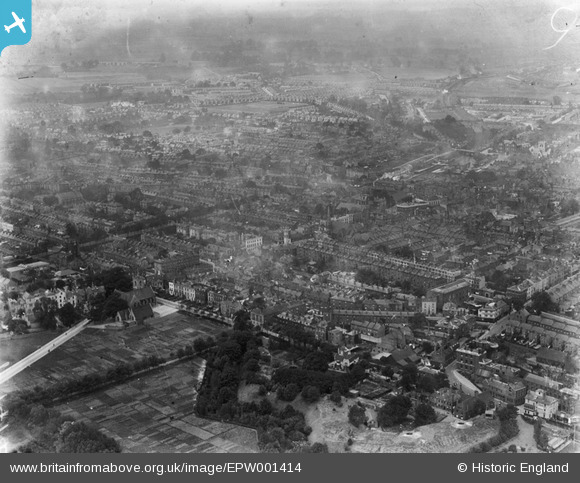
EPW001414 ENGLAND (1920). General view of the town, Gravesend, from the north-east, 1920
© Copyright OpenStreetMap contributors and licensed by the OpenStreetMap Foundation. 2026. Cartography is licensed as CC BY-SA.
Nearby Images (5)
EPW001414

EPW001413

EPW009132

EPW009133

EPW009131

Details
| Title | [EPW001414] General view of the town, Gravesend, from the north-east, 1920 |
| Reference | EPW001414 |
| Date | 7-June-1920 |
| Link | |
| Place name | GRAVESEND |
| Parish | |
| District | |
| Country | ENGLAND |
| Easting / Northing | 565167, 174189 |
| Longitude / Latitude | 0.3768599809003, 51.442086386235 |
| National Grid Reference | TQ652742 |
Pins

Houzi |
Saturday 18th of September 2021 10:21:13 AM | |
|
Kentishman |
Monday 26th of December 2016 08:55:27 PM | |
|
jayneB |
Tuesday 3rd of May 2016 04:05:44 PM | |
|
jason |
Thursday 31st of December 2015 06:54:32 PM | |
|
jason |
Thursday 31st of December 2015 06:51:58 PM | |
|
Kentishman |
Saturday 27th of June 2015 12:09:49 PM | |
|
Kentishman |
Monday 1st of December 2014 09:01:55 AM | |
|
Kentishman |
Wednesday 23rd of July 2014 06:50:46 AM | |
|
Kentishman |
Wednesday 23rd of July 2014 06:48:15 AM | |
|
Kentishman |
Wednesday 23rd of July 2014 06:47:01 AM | |
|
Kentishman |
Sunday 6th of July 2014 05:51:37 PM | |
|
Kentishman |
Sunday 6th of July 2014 10:06:49 AM | |
|
Kentishman |
Sunday 6th of July 2014 10:03:27 AM | |
|
Kentishman |
Sunday 6th of July 2014 09:23:04 AM | |
This is my families church long before my time, births marriages and deaths would all have been here, my mother my aunt, and my grandfather all went to the holy trinity school which was also burnt down. |
jayneB |
Tuesday 3rd of May 2016 04:16:58 PM |
|
Kentishman |
Sunday 6th of July 2014 09:14:12 AM | |
|
Kentishman |
Sunday 6th of July 2014 09:12:24 AM | |
|
Mike Floate |
Saturday 4th of January 2014 07:09:30 PM | |
|
Mike Floate |
Saturday 4th of January 2014 07:07:16 PM |
User Comment Contributions

New Tavern Fort in the foreground: 'For a while early in WWII a light Anti-Aircraft gun and a Searchlight were mounted on the infilled 6 inch gun emplacements. There was also temporary sandbagged Light Machine gun positions nearby overlooking the river. Fort House became an office for the administration of local food rationing, but a German V2 Rocket fell nearby and the building was badly damaged and had to be demolished. The Victorian and 1904 Magazines were used as Air-Raid shelters for a while, then reportedly the Victorian Magazines were used as a temporary Civil Defence Control Centre and then as a radio relay or monitoring station, two high steel pylon towers were constructed for this purpose. An Air Raid Wardens post was also built near the ditch at the south end of the Fort,this was demolished in the 1980's.' http://www.medwaylines.com/newtavernfort.htm |
Kentishman |
Sunday 21st of June 2015 10:45:26 PM |