
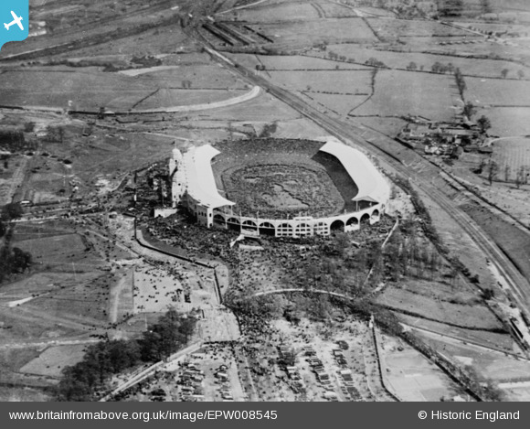
EPW008545 ENGLAND (1923). The British Empire Exhibition Stadium (Wembley Stadium), Wembley Park, 1923. This image has been produced from a copy-negative.
© Copyright OpenStreetMap contributors and licensed by the OpenStreetMap Foundation. 2026. Cartography is licensed as CC BY-SA.
Nearby Images (48)
EPW046909

EPW011412

EPW017636

EPW009655

EPW020862

EPW010462

EPW026433

EPW046913

EPW010456

EAW048878

EPW026438

EAW014141
 Stadium, Wembley Park, 1948. This image has been produced from a damaged negative.")
EAW018311

EPW046905

EPW010461

EPW026431

EAW048879

EPW034581

EAW018312

EPW017635

EPW010458

EPW046907

EAW048875

EAW018313

EPW010459

EPW010457

EPW010460

EAW038566
 at Wembley Stadium, 1951. This image has been produced from a print.")
EPW008076
 under construction, Wembley Park, from the north-west, 1922. This image has been produced from a copy-negative.")
EPW020341

EPW026434

EAW017618

EPW046910

EPW009652

EAW038567
 at Wembley Stadium, 1951. This image has been produced from a print.")
EAW017617

EAW017619

EPW017623

EPW046914

EPW035048

EPW017625

EPW017624

EAW017620

EPW046906

EPW009602

EPW046239

EPW006967

EPR000224

Details
| Title | [EPW008545] The British Empire Exhibition Stadium (Wembley Stadium), Wembley Park, 1923. This image has been produced from a copy-negative. |
| Reference | EPW008545 |
| Date | 1923 |
| Link | |
| Place name | WEMBLEY PARK |
| Parish | |
| District | |
| Country | ENGLAND |
| Easting / Northing | 519326, 185479 |
| Longitude / Latitude | -0.27862142362685, 51.555082471399 |
| National Grid Reference | TQ193855 |
Pins

The Laird |
Tuesday 19th of January 2016 05:08:54 PM |