
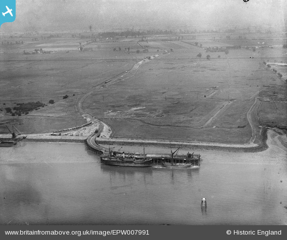
EPW007991 ENGLAND (1922). A jetty on the north bank of the River Thames, Dagenham, 1922
© Copyright OpenStreetMap contributors and licensed by the OpenStreetMap Foundation. 2026. Cartography is licensed as CC BY-SA.
Nearby Images (3)
EPW007991

EPW007990

EPW036784

Details
| Title | [EPW007991] A jetty on the north bank of the River Thames, Dagenham, 1922 |
| Reference | EPW007991 |
| Date | May-1922 |
| Link | |
| Place name | DAGENHAM |
| Parish | |
| District | |
| Country | ENGLAND |
| Easting / Northing | 547968, 182301 |
| Longitude / Latitude | 0.13294927464475, 51.519738453167 |
| National Grid Reference | TQ480823 |
Pins

Horsegunner |
Saturday 4th of May 2013 11:17:51 AM | |

Maurice |
Friday 3rd of May 2013 07:10:26 AM | |
|
Maurice |
Friday 3rd of May 2013 07:03:51 AM | |
|
Maurice |
Friday 3rd of May 2013 07:02:23 AM | |
|
Maurice |
Friday 3rd of May 2013 07:01:49 AM | |
|
Maurice |
Friday 3rd of May 2013 07:00:02 AM | |
|
Maurice |
Friday 3rd of May 2013 06:56:38 AM | |
|
Maurice |
Friday 3rd of May 2013 06:52:58 AM |
User Comment Contributions
Same location as EPW036784 which is entitled A Jetty by Horse Shoe Corner and the Dagenham Marshes, Dagenham, |

Class31 |
Monday 1st of July 2013 12:55:40 PM |
Thanks for the location! We'll update the catalogue along with EPW007990. Yours, Katy Britain from Above Cataloguing Team Leader |
Katy Whitaker |
Monday 1st of July 2013 12:55:40 PM |
Eureka |
Class31 |
Friday 14th of June 2013 04:36:53 PM |
Well done, Class 31 |
Biggles1951 |
Friday 14th of June 2013 04:36:53 PM |
There is no sign of the jetty or the railway on the present day aerial pictures and much of the area in the background has been development with housing, industry and transport facilities, although the marsh area immediately around the dock seems to have been avoided. |
Maurice |
Friday 3rd of May 2013 08:54:43 AM |